
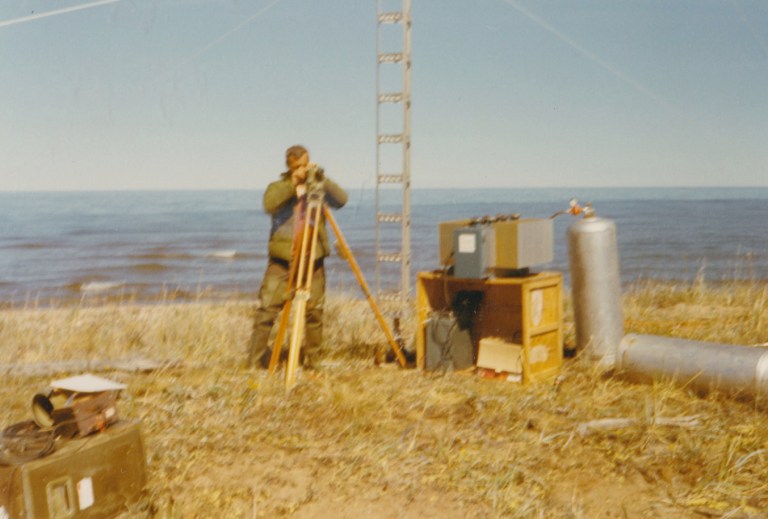
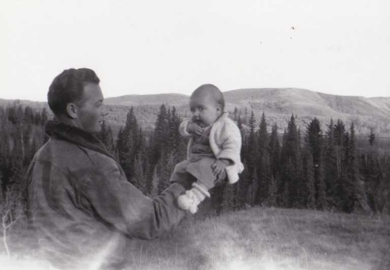
My Papa, when he was young, worked as a Surveyor in Alberta, Saskatchewan, British Columbia, and Canada’s northern Territories. He spent many frozen winters up north, traversing ice roads and navigating by the stars, trying to support his family while leaving my Grama to raise three kids 4+ months out of every year. When he was in his 50s, he founded Canex Explorations, one of the first companies to computerize survey data, and the first group to map the bottom of the Beaufort Sea in the Arctic Ocean. He could finally spend some time at home with my Mom, her brothers, and my Grama.


Surveying is part of global exploration, map-making, and our shared spatial awareness. Technologies associated with surveying have changed significantly over time: from collectively walking the perimeter of a property to co-memorize the boundary line, to contemporary Global Positioning Systems traceable via satellite. Surveying the landscape helps solidify space, establish ownership, divide resources, and create “permanent” boundaries…


… but what happens when the landscape itself is not solid? How can we talk about any space as being ‘permanent’ when mountains rise and fall over millennia, when earthquakes shake holes in the earth, when landslides collapse hillsides, and when rivers flex across the land? Add an element of human hubris (the ‘contained’ landscape) and our understanding of ownership changes again. During sharp natural events, our euclidean understandings of property, ownership, and spatial divisions are forcibly reexamined. Property lines are re-mapped, naturally and officially, and land is lost irretrievably to the shifting of terrain, to the roaring river.
Nature chooses the path of least resistance: like people, nature has her own desire lines. While we divide land, sometimes into blunt right angles, nature has its own plans beyond trigonometry and triangulation.
People who have mapped the land recognize this subtlety, the value of invisible space (like the bottom of a sea), and the psychological influences of geography. My Papa felt a keen awareness of the sun and the stars, of the light and the darkness, of distance and space. He shared stories about travel and topography, following routes taken by Indigenous peoples, of avoiding the wrath of silent carnivores, of driving at night through ice and snow to avoid the (dangerous) shapeless whiteness of daylight hours, and the cold, compassionless dominance of nature over any one individual.
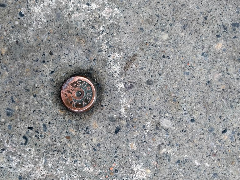
In thinking about mythical deltas, ravenous rivers, and methodologies of mapping the landscape, it is our intention to speak to this subtlety by subverting an everyday material used by surveyors all over the world to help map the landscape: survey monuments. It is our intention to subvert the original function of thousands of survey monuments to create a new map, tying together nature, culture, and the invisible sub-currents of our city.
More to come.
~ Post written by Caitlind r.c. Brown.


It is really inspiring. I would say this is not any easy task to do a survey in frozen winter, But he performed a commendable job. I like your blog. Thumbs up from my side.
LikeLike