
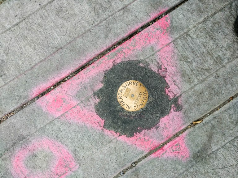
Survey monuments are permanent markers installed to establish a precise geographic location that can be used as a reference point with consistent accuracy. Monuments are inscribed with information and geodetic coordinates as well as a point or symbol in the middle that can be used as a precise center point.
Surveyors can use established survey points to triangulate further geodetic points in space, establishing geographic coordinates (latitude and longitude) as well as elevation.


In some cases, early survey points were historically marked with eclectic objects and techniques ranging from rock cairns and clay pots, to liquor bottles and holes drilled into bedrock. Even a penny with a nail driven through it could serve as a survey marker.


Contemporary monuments come in a variety of sizes, shapes and materials. Circular brass disks are the most commonly used monuments today, with special monuments being created for points of interest and unique border areas such as tripoints.


Interestingly, the term ‘monument’ can also refer to a statue, erected to commemorate a person or event. In contrast with surveying monuments, these statues are traditionally of significant scale and physical presence, intended to be seen and understood by all. While surveying monuments are installed to be permanent, like statues, they’re are used to measure the land around them in different ways as their environment shifts. In this way they are responsive to our society – the sediment of civilization.


6 thoughts on “Monument”